Table of Contents
(?)
Site Page Counts
Public: 510
Restricted: 677
//add in logic required to do stories on each page
require_once './include/story_page_include.php';
include "./include/story_page_nav.php"
?>
The map produced by Shmuel Englander and Dov Bar is extraordinarily detailed and apparently accurate -- after accounting for inevitable errors due to Shmuel's long absence from Volchin, an exaggeration of size most pronounced at the center of the town and generally diminishing toward the periphery; and adjusting for the limitations of physical size of the paper. Note also that their map is oriented with north to the top left of the page, complicating comparisons with standard north-at-top maps.
For the sake of clarity, comparison with standard maps, and systematic presentation here, the map has been redrawn:
 |
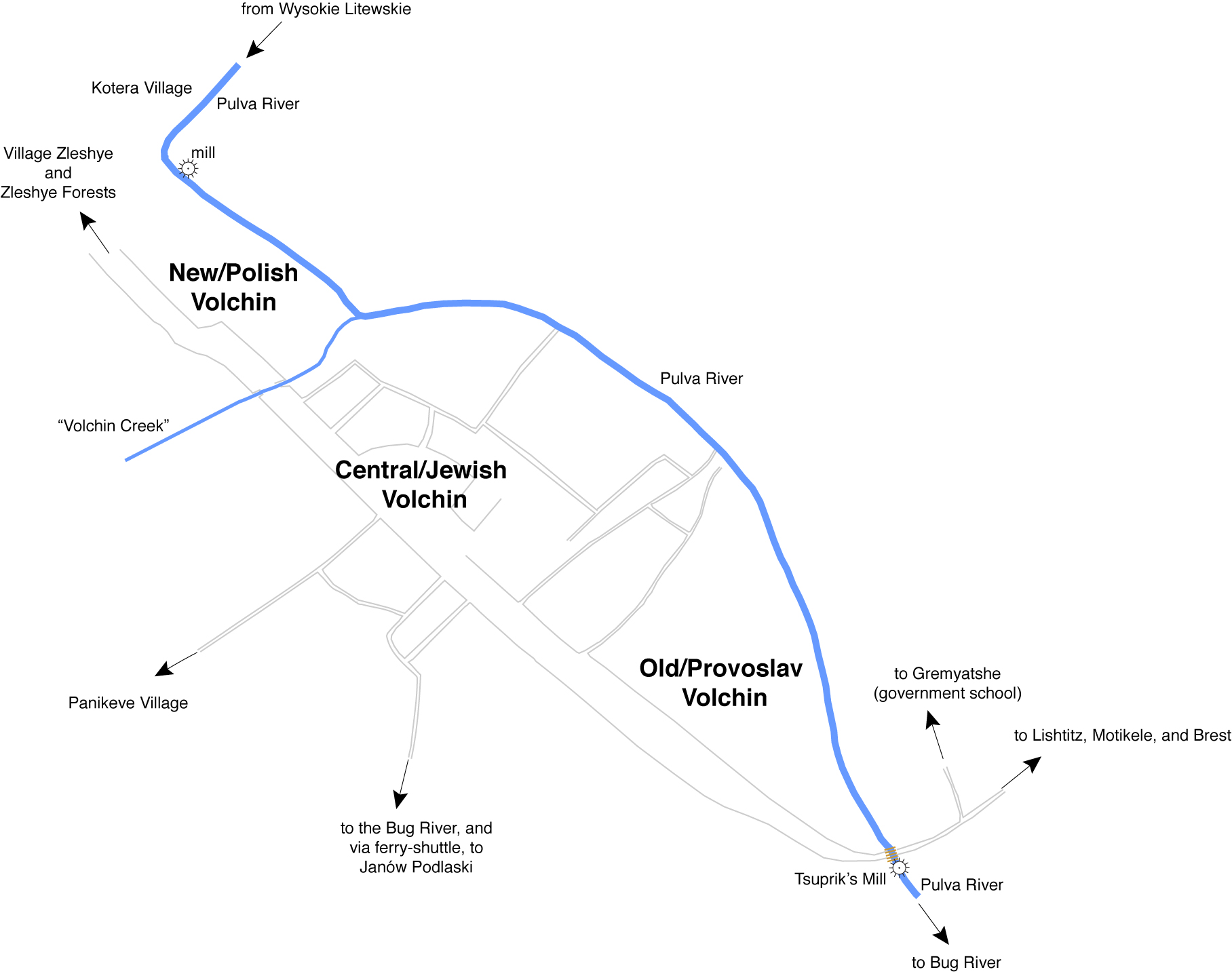
Shmuel Englander's Map, redrawn; in English.
Standard North: (approximately) to top.
Overview showing sections and nearby destinations. |
Shmuel and Dov divided pre-war Volchin into three sections. This discussion uses those divisions:
Explore the northwestern section: New/Polish Volchin
The south boundary of the North-Western Section is a small creek flowing to the northeast into the Pulva River, apparently never named, but given the name “Volchin Creek” for this discussion.
Explore the central section: Jewish Volchin
Not surprisingly, Shmuel's memories were by far most extensive with regard to the central, Jewish portion, and this is clearly reflected in Dov's rendering.
The south boundary of the central section follows the division evident in the original map, with Jewish and Polish buildings to the north and Provoslav homes to the south. Exception: The Provoslav church was located in the midst of the Jewish community.
Explore the south-eastern section: Old/Provoslav Volchin
The symbols and detailed labels on the lower half of the original have been translated and added back to the redrawn map, or --in some cases-- transferred to text in these pages. For reference:
Explore the English Translation of the Original Map Legend
//add in logic required to do stories on each page
require_once './include/story_page_include.php';
include "./include/story_page_nav.php"
?>
| Editor's Note: size of the paper: The redrawn map corrects the direction of the roads leading toward Panikeve village (to the southwest rather than west) and to the Bug River (to the south rather than southeast) both of which were distorted in the original due to space limitations. |